
|
Location Links | Location Search | |
| Gazetteer | Feature Finder | ||
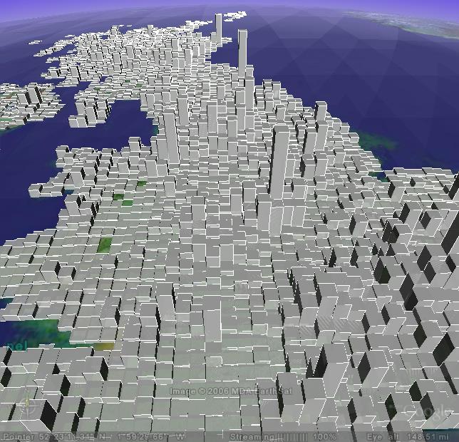 The following is a screen shot from Google Earth showing a 3-dimensional bar map depicting the number of Geograph Images by Hectad, click the image to view full size. However to appreciate this information you really need to download the KMZ file (294kb) and open it your Google Earth. Enjoy!
Tip: Select the Layer in My Places and drag the Transparency Slider to see the map though the bars!
Tip 2: You can enable the 'Labels' layer to see the Grid Reference for each hectad, don't use when zoomed out otherwise will be rather crowded.
Note, that the coastline depicted in Google Earth may not exactly match that of Geograph (which is based on OS maps).
Last updated: 18th Feb 2006